Thursday, November 1, 2012

Dreamin' on Pipe Dream Trail


This sign said the trail is for advanced riders, expert only, yep, they were right!  It was a lot of fun too!  I did the Pipe Dream Trail on the day after I did Bull run.  This. Trail. Is. Hard.  It is located just south and above Moab and I can see riders like to get riding on this right from town.  It is a great technical trail

 Going under a boulder.
 I loved the switchbacks on this trail.  Fun!  Also with lot's of boulders to go over and steep side sections.  Lot's of up and down riding with 1,000 vertical feet of total climbing.

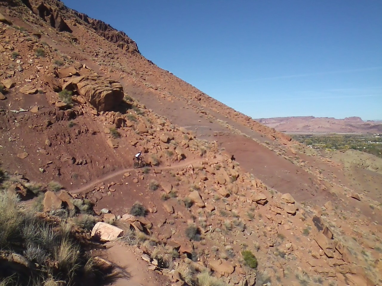
There's a biker down there.  Yeah, she passed me and we were talking about how fun the trail was.

 This a hard section, fun but ridable.
I was going to do an out and back which was 10 miles total but my hands were too fatigue from a lot of braking.  So I did a loop by doing a return on the Pipeline Road.  I liked this trail because it was challenging.

Biking with the Bulls on Bull Run Trail

 This was a really nice, fun trail with a bunch of sweetness added to it!  That's all I can say!

 A lot of this had slickrock and dirt variation kind of trail.

 I don't why I keep taking pictures of the easy parts of the trail, so this is not most of it.  There were a lot of sections, with boulders, slickrock, drops, and with gnarly climbs.
 Went down for a nice trip to Moab, my parents came along.  It was very nice, perfect weather and that's what made the trip more enjoyable.  It was a 5 mile trail and I did it out and back with a total of 10 miles.  The Bull Run is the first part of the Mag 7 Trail series.  They say the Bull Run is the funnest part of the Mag 7.  I agreed, it was a fun section and I had a blast.  I started From Gemini Bridges and went uphill with about 1,000 vertical feet of climbing, then I went back down with a fun downhill. 
 There were some cliff side riding and lots of fun boulders to go over.

I turned around here at the top.  The continous trail was 7 Up and I wanted to go more on it but I turned around because it was getting dark.  Next time, I will make sure I have more time to ride.

Horseshoe Canyon Hike

 On UEA weekend, the Tony family invited us to go see some pictographs in Horseshoe Canyon located in Canyonlands National Park.  The hike was around 7 miles out and back.  It goes down into a sweet looking canyon with pictographs in most areas.
 Brayden checking them out.
 This one means "Holy Ghost"  and this one is very big.
 Most of the hike was on a sandy wash and was fun to walk on it through the canyon.  The hike up back from down the canyon was a 700 vertical foot climb and was it a good workout.  The hike took about 5 hours.  It was great fun!  My parents came but they only hiked a couple miles.  We still had fun.  We had Stan's Burgers in Hanksville afterwards.
 More pictographs.
 Tony and Hannah walking.
 Hannah.
 It was great to hike and see this stuff!
This guy stole my nephew's trail mix while we were sitting looking at some pictographs, now I got a picture of him and I can report it.  Ha ha.  Well, we were taking about he probably needed it worse than we did.

Saturday, October 6, 2012

Maybe! It would be nice though!


This would be really great if this happens.....The blue markings on this map above to be a bike trail.   I did some trail scouting up there like 3 months ago then looked again lastnight.  It would work, and it would be nice.  It would also be a lot of hard work.  I don't care if it takes a long time but the reward would be great.  The red markings is the trail I built this summer and it's working out great on the riding and not hard at all.  The point is that I am trying to make a good uphill singletrack to the top of the popular downhill Flume Trail.  The new trail would be a lot of switchbacks and then through some trees and up to Taylor's Flat crossing the canyon road.  If this works, it would so awesome, I mean awesome awesome.
This is on BLM land and I hope I could do it legally.  I know I can't on US Forest Land and in fact we got trouble for building the Pioneer, Maple Syrup, and Bovine trails which they are on Forest Land.   We just heard that they are shutting them down.  Anyways, the new bike store downtown is creating a bike club through IMBA to try to keep them open.  So I am crossing my fingers on this one.  At least keep them open for mountain bikers and hikers.  Would be really great if they keep them for motor bikers too.
First, I am going to talk to a few people to get information on the laws for BLM land.  Hopefully I could start building this trail next spring.

Saturday, September 8, 2012

American Fork Canyon Mountain Biking

 For Labor Day, all I wanted to do is not work.  Had somebody asked me to help them out on that day already but I said, "Nope, going to be gone."  All I wanted to do is go on a bike ride, a fun one.  I decided to go up north with my mom and she said she would wait for me while I go on my ride.  We went up to American Fork Canyon and there was a LOT of people.  Once I got on the trail and trailhead, it wasn't so bad.  While I went on a ride, my mom sat on a lawn chair in the shade and read a book, which she enjoyed. 
 The trail I did was called Deer Creek South Fork Loop.  It consisted around 7 miles long and all singletrack.  The first part of it was all climbing and was tough.  Then I got on Ridge 157 Trail with up and down riding with AWESOME views of Timpanogus Mountain and other places. 
 The singletrack was not too technical and was mostly hardpack but very fun.  I loved my new Maxxis Crossmark and Ignitor tires.
 Some of Timpanogus Mountain.
 There are a lot other trails up there.  The bad side is that you got to pay a fee to get in the canyon but thank goodness my mom had a senior citizen National Parks pass.  So we got in free.  I guess you got to always pay to ride on some good trails, oh well.
The last part of the loop was all downhill.  Lot's of fast turns and whoops through the pine trees and aspens.  Great fun!!!  Anyways, after we were done, we met my sister at Olive Garden in Sandy to eat.

Sunday, August 19, 2012

Thunder Mountain Trail and Bryce Canyon

 This was a fantastic trail!  It was very unique and one of a kind I thought.  This trail is about ten miles northwest of Bryce Canyon National Park and located in Red Canyon.  I decided this trail is a must do for me while my family went to Bryce Canyon for a weekend getaway.
 The trees were awesome I thought, being in this forest reminded me a lot of Flagstaff, AZ.  The soil was an orangey color and looked cool.
 Great views and very high at the top, I say around 7,500 ft to 8,000 ft elevation which felt pretty cool compared to desert riding especially in the morning.
I started at the Thunder Mountain Trailhead and just decided to do the loop by going up the paved trail up to the Coyote Hollow Trailhead.  Just going up Thunder Mountain would be too steep so going down it would be more pleasant.  The climb up the paved trail was not bad at all and was very nice.  It was 5.5 miles on the paved trail and 2 miles on the dirt road so it took me around 45 mins.  The elevation gain was 1,200 ft.
 I thought all the climbing would be over going down the trail but nope, still a lot of short bursts of climbing on the trail and I was totally spent.  I was so spent I ended up walking on some of them.  I just didn't have energy anymore but anyways, I still had fun on most of the downhills.
 Hoo doo.
 Awesome wrap around trail around the hoo doos.
 The whole loop was 16 miles and was an awesome ride.  The best part was the scenery.  I also want to do the Cassidy/Lossee Loop next time which is on the other side of Red Canyon and goes through the Butch Cassidy Canyon.  It's supposed to be a world class ride so I'll try it sometime.
 During the rest time of the trip, I had a lot of fun spending time with my parents and little sister sightseeing Bryce Canyon.  I thought it was very awesome.  There were quite of few people in the park but no one at all at the Red Canyon/Thunder Mountain area.  Only saw two hikers in Thunder Mountain and there were people from all over the world at Bryce Canyon.  Will have to go down there again and I learned a lot.   

Saturday, August 11, 2012

Mountain bike busting again...

I have been doing quite of bit of mountain biking in the past month and it's been great!  It all started during the Deer Valley Trip and ever since I have been feeling good.  My legs feel a lot better and I feel I have more strength.   Also, all rested up.  Not much as the burning sensation feel in my leg muscles anymore.  I have been doing a lot of riding at home.  Mostly on the Flume Trail and this new trail I repaired from the hydroplant to New Canyon for the uphill route.  Before, the old trail that used to be there was destroyed by pipe line construction workers.  After they were done about 3-4 weeks later, they finished it off by putting a lot of boulders and rocks over it for blocking the cars.  So I cleared enough room for a singletrack trail and made it a lot better than the old trail was.  Added some turns and the climbing is easier.  It's fun downhill also.  I spent maybe a day and a half on it, mostly clearing rocks and medium sized boulders(they could be barely be moved by one person).  Then a lot of shoveling. 
 The start of new trail, short but fun.  Sure beats going up the main canyon road.
 I call this the Rock Garden section. 
So, I have been climbing up the trail quite of few times up to the creek past New Canyon and over to the top of the Flume.  Good rides.  It's really been good to do some hard mountain biking again and it's been a long time.  During the off time, I've been doing quite of bit of easy spinning road riding.  It paid off though.  Next weekend, I am looking forward to try some mountain bike riding down at Bryce Canyon.  Heard some pretty fun trails there, such as Thunder Mountain Trail and Cassidy/Lossee Trail.  Don't know which I'll do but I'll decide which one I'll do when I get there.  Going down there for a mini family trip.  Bryce Canyon is the only National Park in Utah I haven't been to and wanted to see it for years.  It's only 2 days long though, should be fun.